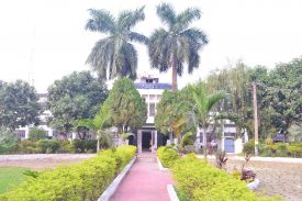
ABOUT DISTRICT COURT
Katihar district, the land of banana, was created on 2nd October 1973 by splitting up the earlier district of Purnea. Katihar is located at 25.53° N 87.58° E. It has an average elevation of 20 meters. The main rivers of the District are mighty Ganga (southern boundary, 25 kilometers from Katihar Town), magnificent Kosi (western boundary, 30 kilometers from Katihar Town) and beautiful Mahananda besides many other small rivers like Kari Kosi (flowing by the side of Katihar town), Kamla etc. The Kosi (Sorrow of Bihar) merges with Ganga at the south-west boundary of Katihar District. This District shares boundary with two states i.e. Jharkhand at the southern side and West Bengal at the eastern side. The Bangladesh lies around 80 km east of Katihar town and Nepal lies around 100 km north of Katihar Town. There is rail connectivity to both the borders from Katihar railway station. Its proximity to the Himalayas in the north, Jharkhand plateu in the south and a multiple of rivers combined with good rainfall gives it a distinct climate which can be termed more or less pleasant during most of the year. The rainy season flood is an annual feature. Headquarters: Area:3,057sqkm Population: Total:1825380[...]
Read More- Notice Regarding Advertisement No.-01/2024 (DLSA, Katihar)
- Notice Regarding Stenographer Pursuant to Employment Notice No. 02/2022
- Notice Regarding Court Reader-cum-Deposition writer Pursuant to Employment Notice No. 03/2022
- Employment Notice No.-01/2024
- Notice Regarding the Interview of Para Legal Volunteers
- Advertisement of Para Legal Volunteers in DLSA, Katihar
- List of Shortlisted Candidates for Interview of sweepers on daily wage basis
- Advertisement of vacancies for the post of Calss-III and IV in the Civil Courts of Bihar
No post to display
eCOURT SERVICES

CASE STATUS
CASE STATUS

COURT ORDER
COURT ORDER

CAUSE LIST
CAUSE LIST


